Public Transit Mobile App
Who hasn’t felt excited and maybe a little paranoid when they are traveling to a destination or a bus station? We want our commute, whether regular or occasional, to run smoothly from the very beginning. So, we try to remember whether we’ve locked doors, turned off home appliances, check bags to make sure that everything is in place.
Once we’re satisfied with these things, it’s time to think about our commute. How are we getting from the bus stop or metro station to the destination where we’re staying? Where’s the nearest public transport stop to a property? How much will it cost and how long does the travel take? A lot of questions arise in our minds.
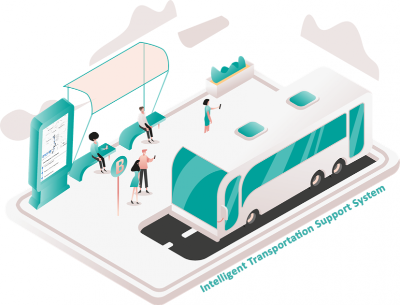
About Intelligent Transport Support System (ITSS)
As cities grow, urban transportation is becoming an issue of increasing salience. To modernize Transport services for commuter comfort, Transit strives to strengthen information systems and improve processes through the introduction of intelligent technology solutions.
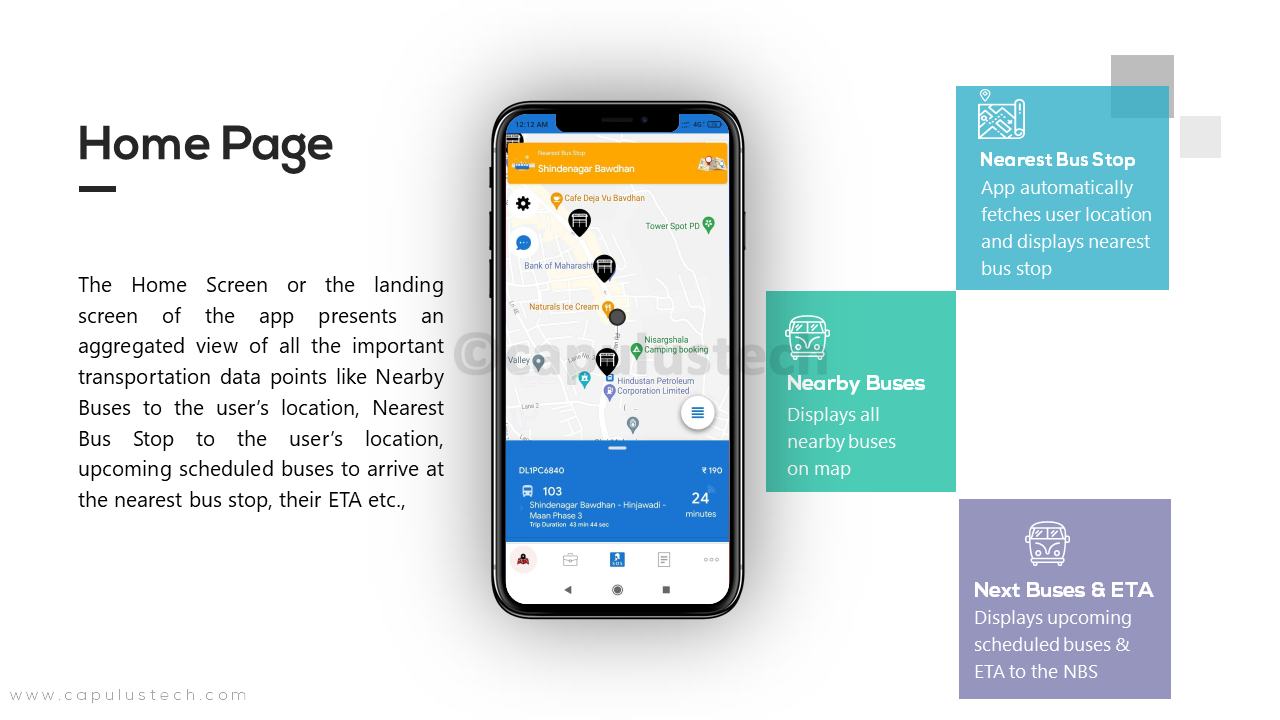
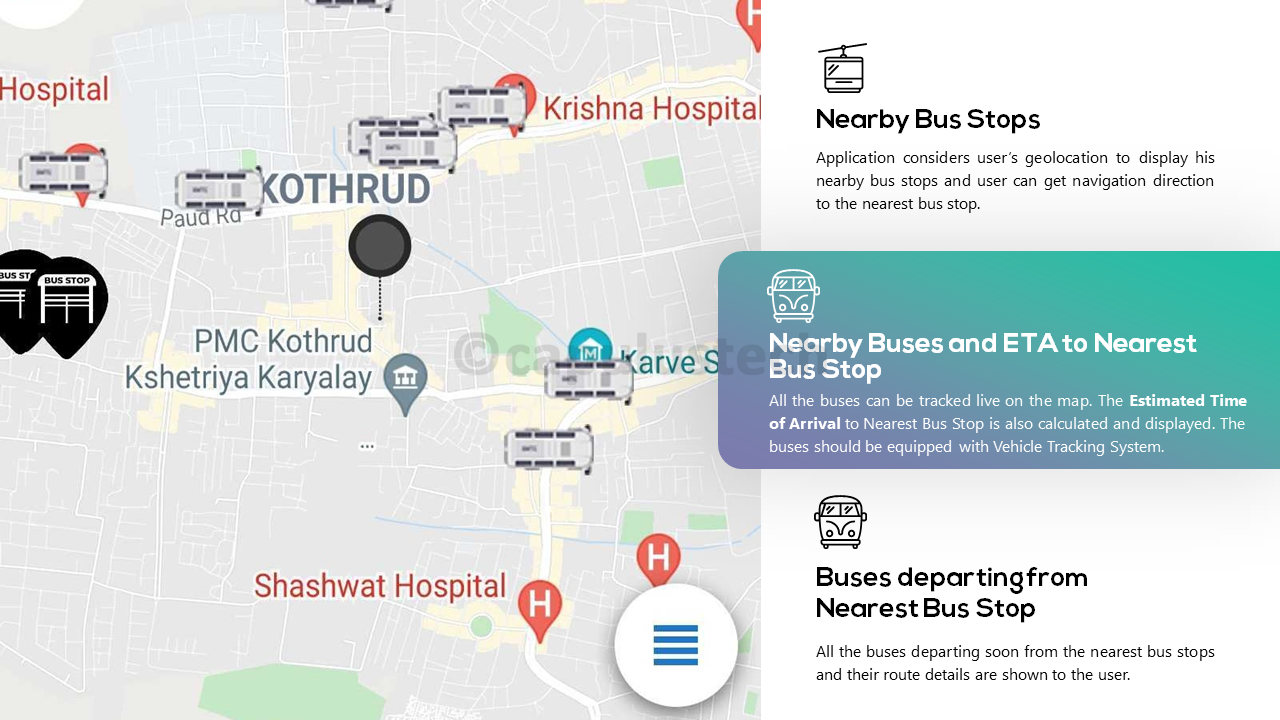
Our Public Transit Mobile App solution helps travelers with complete information like nearest bus stops, the number of buses that go to the required destination, bus numbers, bus timings, the routes through which the bus would pass, schedules, maps that would guide the passenger with user route and most importantly, track the current location of the bus and give the correct ETA for the bus to reach our bus stop.
Application Features
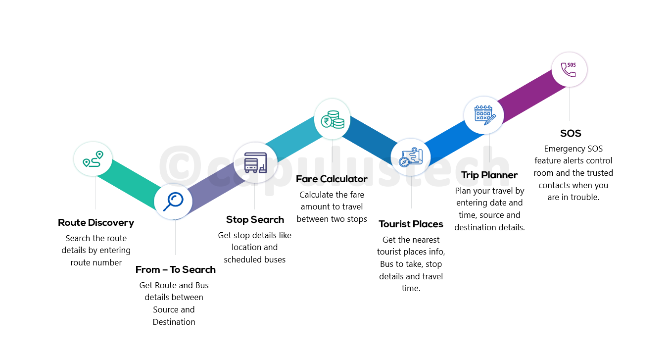
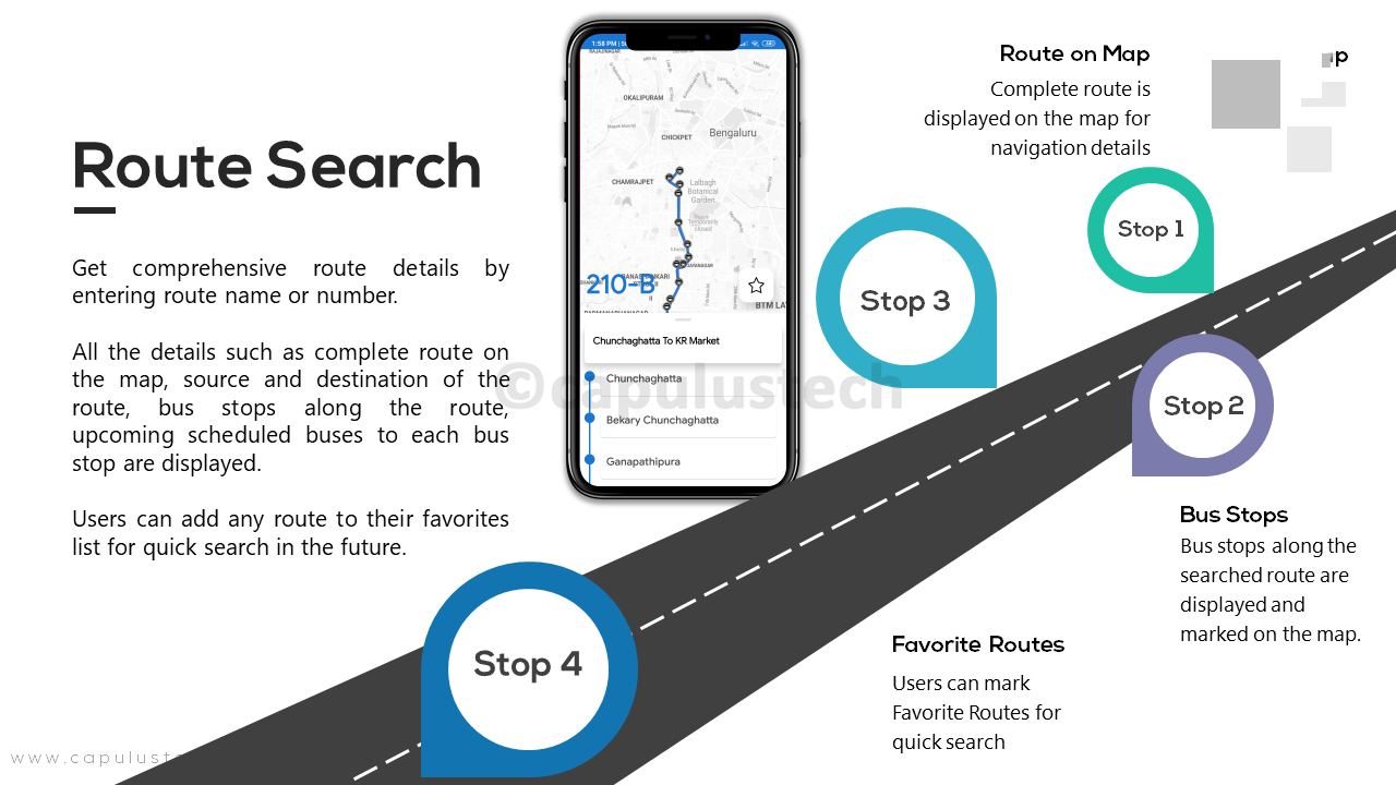
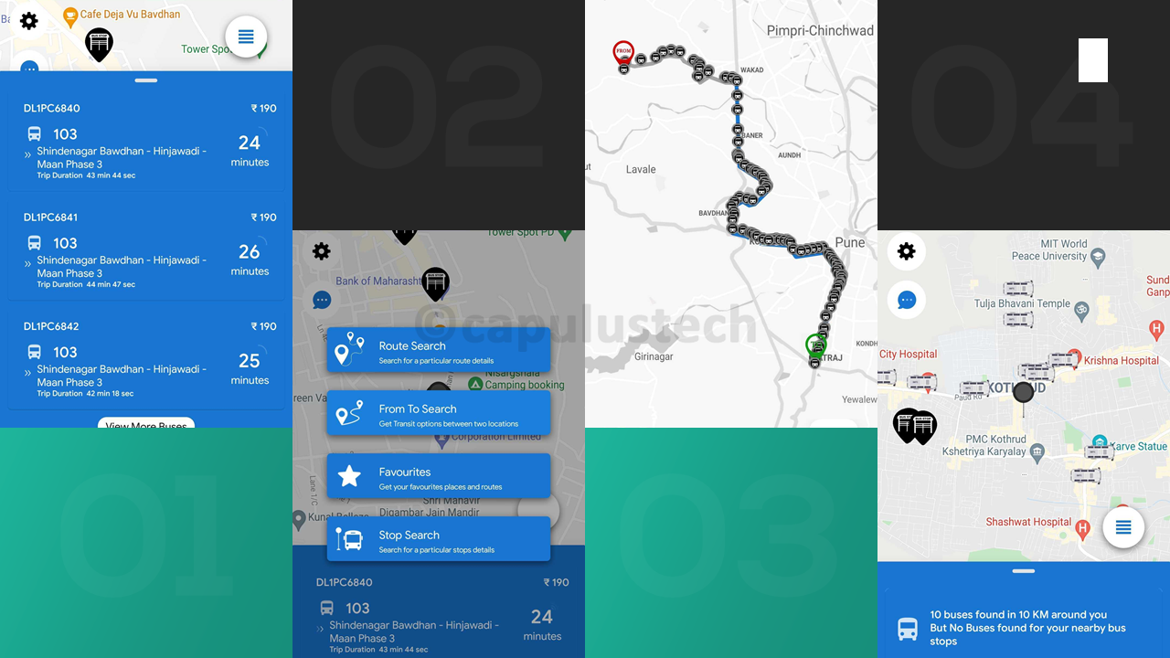
1. Route Search

Application displays the complete route-track on the map along with the details like stops along the route, sequence of stops through which the bus passes and expected time of arrival at each stop.
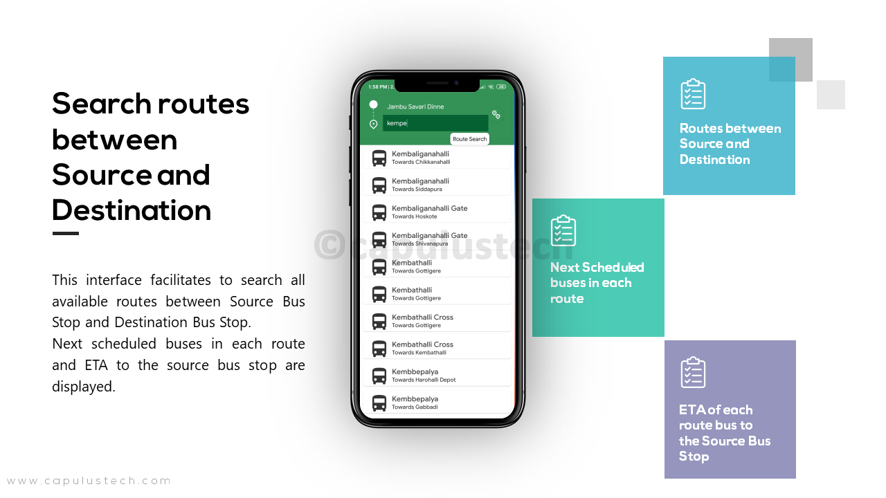
2. From – To Search

Enter source bus stop and the destination bus stop into the application to get available routes and next scheduled buses for each of those route and fare details.
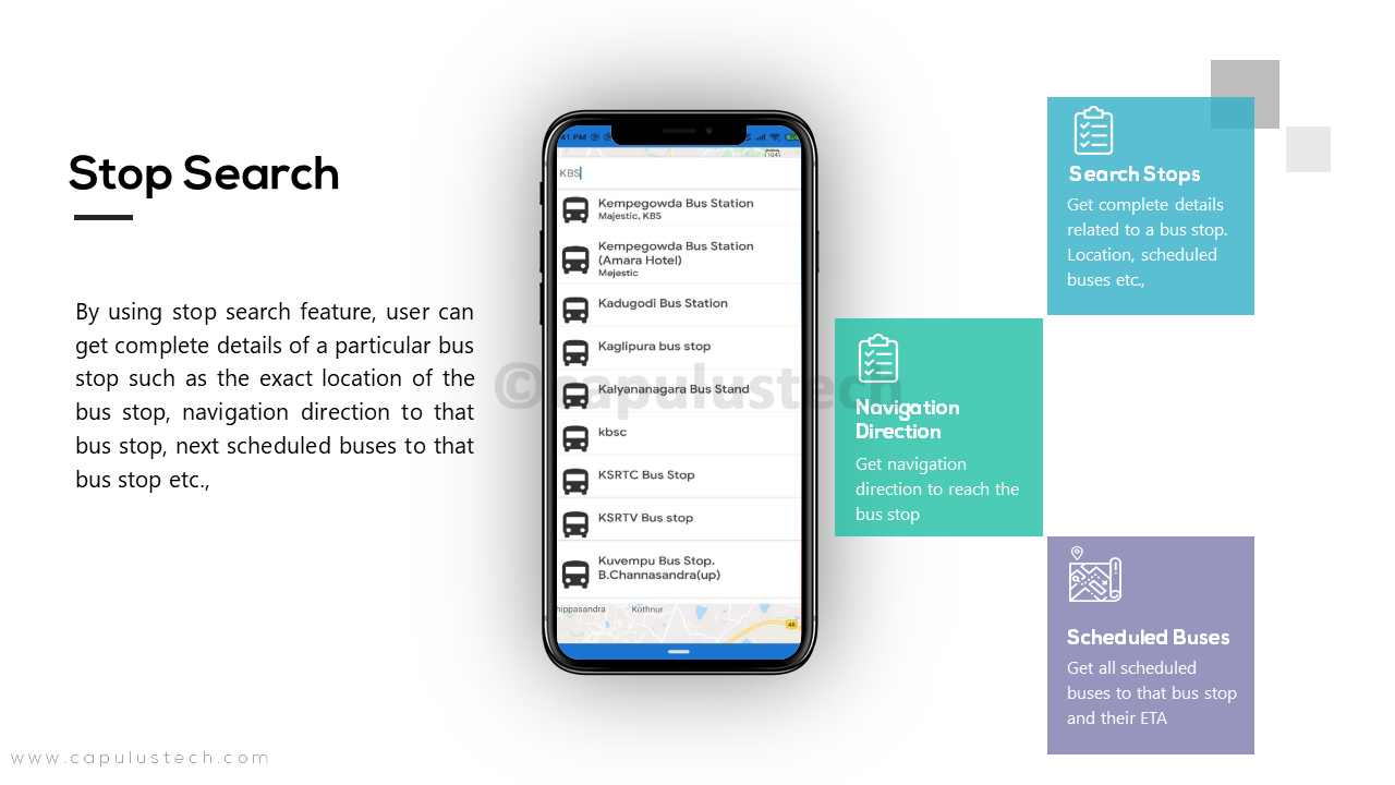
3. Stop Search

Search for the details of any stop in the city like the location of that stop, distance from your location, direction to the stop, next scheduled buses to that stop, etc.,
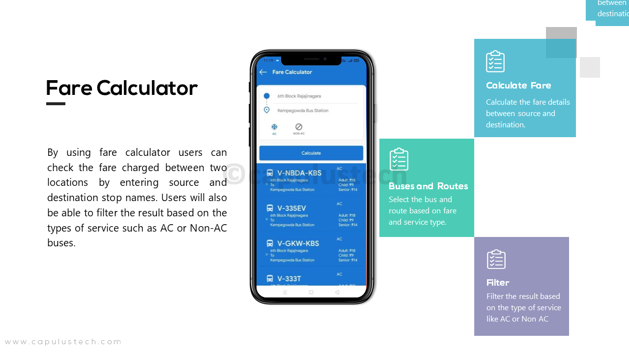
4. Fare Calculator

Calculate the bus fare to travel between source bus stop to the destination bus stop for each route.
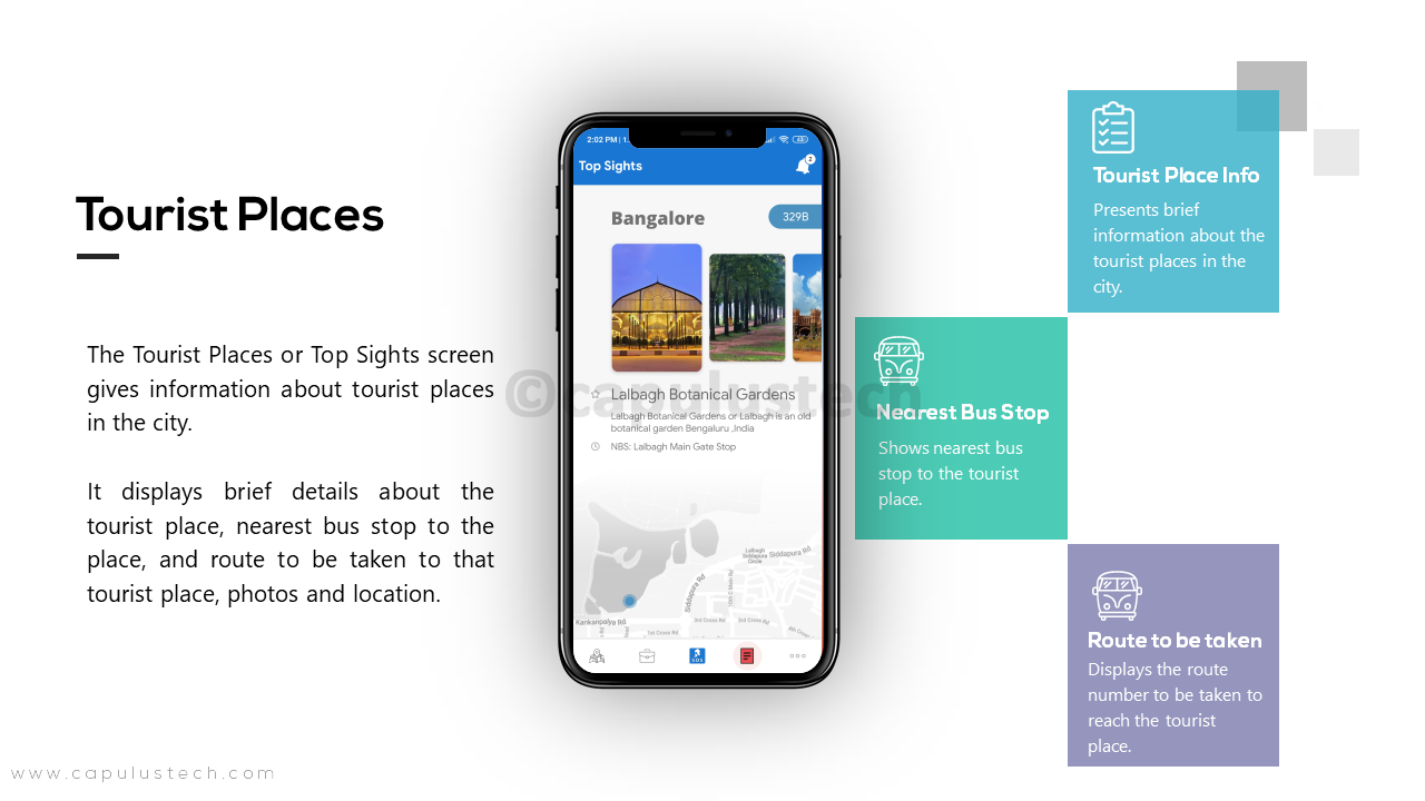
5. Tourist Places

Get the nearest tourist places info, Bus to take, stop details, and travel time.
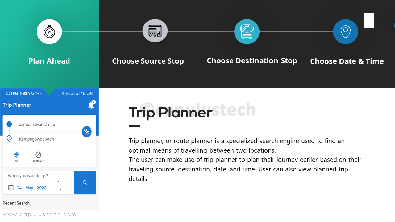
6. Trip Planner

Plan your travel by entering date and time, source and destination details.
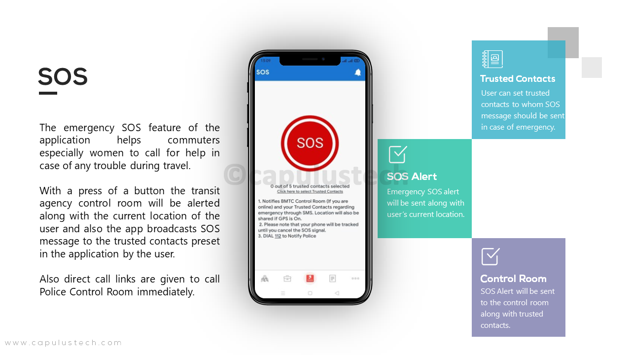
7. SOS

When SOS button is pressed, the user location will be tracked continuously. An emergency alert message with their current location will be shared to the transit agency control room and preset trusted contacts
“Compatible with Global Transit Feed Specification (GTFS)”
Since its creation in 2005, GTFS or General Transit Feed Specification has become a global standard in transit data landscape. GTFS defines a common format worldwide for public transportation schedules and associated geographic information. Being part of the GTFS standard and publicly publishing route data allows transit agencies to enable riders in planning trips more easily, thus increasing ridership for the agency. Our applications are built entirely using the GTFS standards and are compatible with all the transit agencies and their ITS which can publish their data in the GTFS format.
Previous
Next

