GIS based Black Spot Identification
GIS-Based Black Spot Identification: Enhancing Safety and Planning
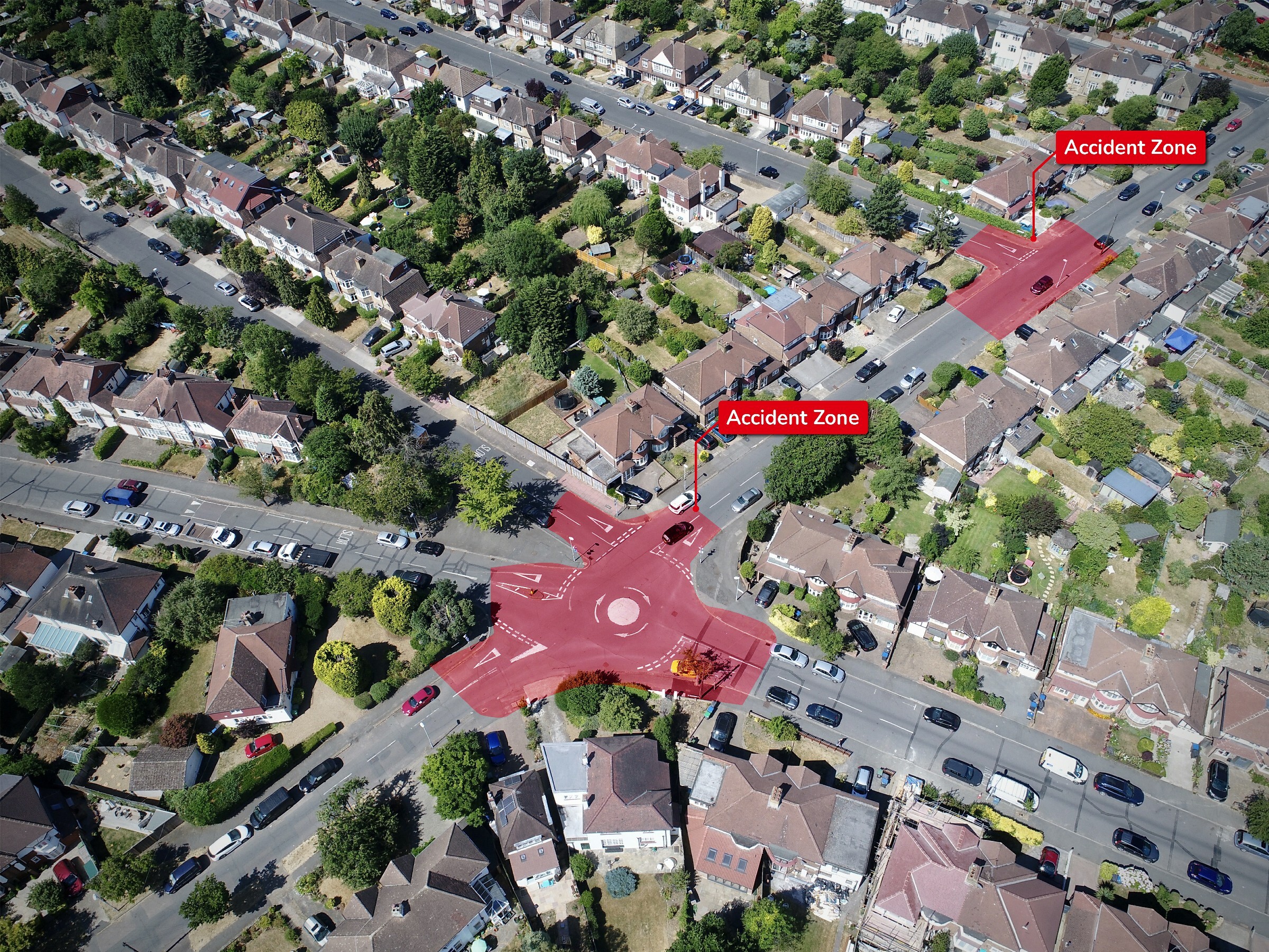
Our GIS-based Black Spot Identification solution harnesses the power of artificial intelligence and Geographic Information System (GIS) technology to identify accident-prone or high-crime areas, commonly known as “blackspots,” on roads. By leveraging historical data, road network information, and relevant data sources, our AI-powered system effectively identifies locations that are more susceptible to accidents or crimes.
Accident-Prone Zones: Using advanced machine learning algorithms, our solution analyzes data patterns to create a map of accident-prone zones. These zones highlight areas with a higher likelihood of accidents, enabling law enforcement agencies, Public Works Departments (PWD), and development boards to focus their resources on implementing targeted safety measures. By identifying accident-prone areas, proactive measures can be taken to mitigate risks and improve overall road safety.
Safety Zones: Alongside identifying accident-prone zones, our GIS-based system can also identify and demarcate safety zones. These zones help designate areas where safety measures, such as traffic calming measures, enhanced signage, or improved lighting, can be implemented to reduce the risk of accidents and ensure the safety of road users.
Crowded Areas: Our solution’s advanced analytics can also identify and mark crowded areas within a given geographic region. By leveraging real-time data and historical patterns, this feature assists in identifying areas that are likely to experience high footfall or congestion. This information can be utilized by law enforcement agencies, event organizers, and urban planners to enhance crowd management strategies and ensure public safety.
White Spots: In addition to blackspots, our system can also identify “white spots” or areas with a low occurrence of accidents or crimes. This information is valuable for identifying well-performing sections of road networks and allocating resources accordingly. It aids in prioritizing maintenance efforts, optimizing traffic flow, and improving overall infrastructure planning.
Our GIS-based Black Spot Identification solution finds applications across multiple sectors, including law enforcement, Public Works Departments, and development boards. By leveraging the power of AI and GIS technology, organizations can proactively identify high-risk areas, plan targeted safety measures, and allocate resources effectively. This comprehensive approach improves road safety, enhances public security, and enables informed decision-making for infrastructure development.
With our GIS-based Black Spot Identification solution, organizations gain actionable insights into accident-prone areas, safety zones, crowded areas, and white spots. This empowers them to prioritize safety measures, optimize resource allocation, and contribute to creating safer and more secure environments for communities and road users.


